
Floating offshore wind potential offers more than two times the energy equivalent of annual U.S. electricity consumption, even after accounting for relative technical suitability in support of responsible offshore wind energy deployment.
Integrated Energy Systems Office
September 15, 2022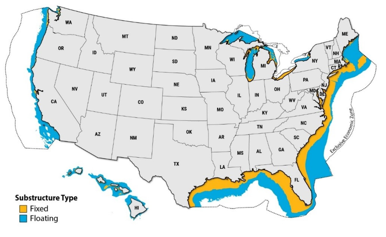
This map represents potential areas for fixed-bottom and floating offshore wind energy technology before considering siting constraints but including a water depth constraint of 1,300 meters.
The National Renewable Energy Laboratory released an updated Offshore Wind Resource Assessment characterizing the nation’s vast offshore wind energy potential. This latest assessment considers technology advancements and the improving economics of offshore wind energy in more moderate resource sites and in deeper waters resulting in a notable increase relative to prior work.
Assuming 60 meters represents a maximum water depth for fixed-bottom offshore wind turbines, the assessment identifies 1.5 terawatts in technical resource potential from fixed-bottom wind farms and 2.8 terawatts from floating offshore wind farms across eight geographic areas in the contiguous United States. This represents regional and national opportunities for offshore wind energy development.
Because marine environmental, jurisdictional, and socioeconomic considerations can influence the availability and leasing of offshore waters for wind energy development, this assessment accounts for areas that may be less suitable to develop due to existing infrastructure, environmental considerations (such as sensitive marine species and habitat), U.S. Department of Defense operations, and other constraints.
This project announcement supports the Floating Offshore Wind Shot, which aims to drive U.S. leadership in floating offshore wind.