
The Office of Fossil Energy’s National Energy Technology Laboratory and the Commonwealth of Pennsylvania’s Department of Environmental Protection have entered into a new data-sharing agreement that promises to improve methods of locating abandoned ...
Hydrocarbons and Geothermal Energy Office
June 5, 2014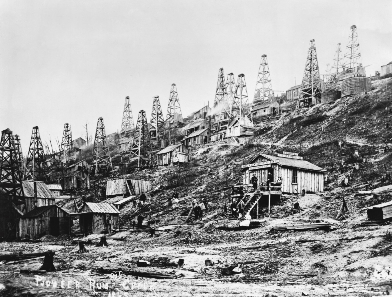
Photo courtesy of the Drake Well Museum, Pennsylvania. Historical and Museum Commission
The Office of Fossil Energy’s National Energy Technology Laboratory (NETL) and the Commonwealth of Pennsylvania’s Department of Environmental Protection (DEP) have entered into a new data-sharing agreement that promises to improve methods of locating abandoned oil and gas wells. The DEP is engaged in an ongoing effort to discover and seal abandoned wells in Pennsylvania, while NETL has developed survey techniques that make it easier to find such wells. The data-sharing agreement will allow for research results to quickly benefit the Commonwealth and will provide NETL with a greater ability to assess the effectiveness of its survey technologies.
Abandoned oil and gas wells pose a serious environmental and economic problem. Wellbores that have not been properly sealed provide potential pathways for methane gas to seep to the surface, where it can trigger explosions, contaminate water supplies, or impact modern drilling operations. The U.S. Environmental Protection Agency estimates that 1.2 million abandoned oil and gas wells exist nationwide; about 200,000 of them are in Pennsylvania, according to the DEP
Locating these wells can be a challenge. Some abandoned wells may be discovered through state records, but these are incomplete. The first oil well was drilled in Pennsylvania before the Civil War, and yet no legal requirement existed to record well positions until 1921. Even when well records do exist, inaccuracies in the records — combined with possible changes in terrain and vegetation — make locating the wells on the ground difficult.
NETL has been researching the issue of abandoned wells for many years. In 2012, NETL investigators conducted a magnetic survey, via helicopter, over a large swath of land involved in active Marcellus Shale gas development in Washington County, Pennsylvania. Using a magnetometer to detect the magnetic signature of well casings — and proprietary hardware and software to compensate for magnetic aberrations caused by the maneuvering of the helicopter, electronic interference, and eddy currents — 15 abandoned wells were identified.
To locate wells that may have been missed by the aerial magnetic survey, the investigators studied publically available surface-elevation data and combed through historic aerial photographs. In one 1939 farm photograph, they discovered evidence of two more abandoned wells. These had not shown up on the aerial survey because their casings had been removed — likely during a scrap metal drive during one of the world wars.
When the investigators compared their findings to existing well records, they found that, of the 17 identified wells, only 6 were recorded in the state database, confirming the existence of numerous undocumented wells. Of the documented wells, the locations in the records were often inaccurate.
The legacy of abandoned wells represents a complex challenge to the environmentally safe and efficient recovery of Pennsylvania’s oil and natural gas. Under the new agreement, NETL and the DEP are now in a position to leverage their respective talents and abilities to advance methods of identifying and managing these wells.